St. Barts Map
Gustavia Harbor Tour
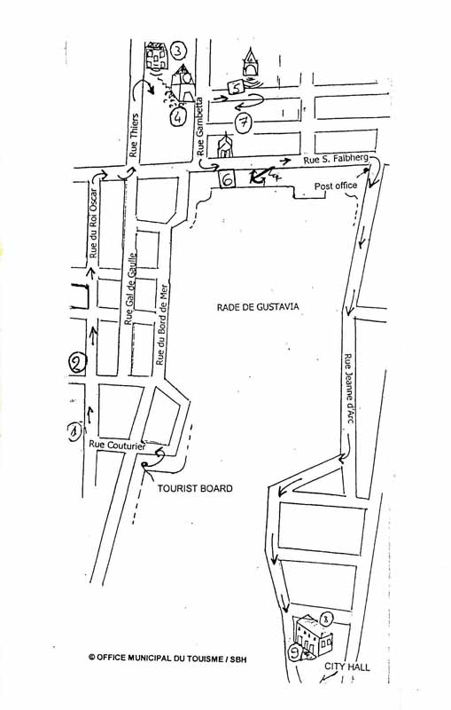
All Caribbean Islands

Hotel Search

Cruise Planning

Excursions Sightseeing Tours

Caribbean Food and Drink Recipes

Caribbean Weather


Essentials
Home
All Islands
Caribbean Map
Photo Gallery
Travel Tips
Site Index
GTCV Forum
______________
Island Vacations
Island Descriptions
When To Go
Where To Stay
What It Costs
What To Do
Air Travel
Car Rental
Luxury Travel
Weddings & Honeymoons
_______________
Cruise Vacations
Planning Tips
Cruise Costs
Cruise Ports
Dining Menus
Shore Excursions
Staying Healthy
What To Pack
Ship Reviews
________________
General Travel Info
Weather & Seasons
Caribbean History
Flora & Fauna
Currency Converter
Travel Insurance
Travel News
Caribbean Calendar
____________
All Topics
Links
____________
GTCV.com
About Us
Contact Us
Disclaimer
Copyright Notice


St. Barth Map
Gustavia City Tour

The Port of Gustavia, now one of the most photogenic in all the Caribbean, before 1950 was just a small village with a few homes, a handfuil of businesses and several Swedish buildings in ruins.

The increase in tourism In the 1980s prompted the municipality to develop and modernize its  harbor facilities.  As you can see, the results were outstanding.  

There are a total of 9 stops on this walking tour, which circuits the main section of Gustavia Harbor.

Start from The Tourist Office, taking Rue Couturier to Rue du Roi Oscar (King Oscar Street) and the first stop, the Former City Hall.

All 9 locations with links are listed at the end of the following map.

St. Barts Map Gustavia Walking Tour

1.
Former Town Hall

2. Hotel de Gouvernement